Our history
Visit our interactive asset map to see information about our community’s history, public amenities, businesses, and much more!
Statement of Significance
Prepared by Tracy Teh
Summary of Heritage Significance:
The Highland Park community has heritage value for:
Centre Street – significant for its major transportation activity dating back to the streetcar and trolley bus to its position as a major vehicle route, as well as its local commercial activity. (Activity)
Highland Industrial (Greenview Industrial) – Historical local employment. (Activity)
Streetscape and permeable grid residential road pattern. (Design)
Historic collection of homes from:
Cluster of pre-World War II houses on 34th AVE NE. (Style)
Unique slope adaptive buildings. (Style)
Community wide small, low profile bungalows. (Style)
Highland Park NW ravine – prominent geographical landmark on Nose Hill’s southern slope providing significant visual value for its treed landscape, in addition, it has played an important part in the community history from when it was first farmed to when it became a neighbourhood golf course. (Landmark and Symbolic)
Description
This northern neighbourhood located SE of Nose Hill, was once prairie cut up by ravines. A large portion is on a flat plateau looking out over the Nose Creek valley. On the eastern edge of the plateau along Centre ST N a steep escarpment physically bisects the residential area. In the NW corner a Nose Creek tributary runs through a steep walled coulee that is land formerly known as Highland Golf & Country Club. The neighbourhood is bounded to the east by Edmonton TR, a remnant of an old wagon trail that was once a historic transportation route to Edmonton. Along the northern boundary runs McKnight BLVD, named after the Battle of Britain pilot William McKnight. The boundary then joins Laycock DR which is named after a well-known family that homesteaded the area. The neighbourhood is bounded to the west by 4th ST and Queen’s Park cemetery. 32 AVE marks the southernmost boundary; site of the number 3 electric streetcar terminus and location of Highland Park’s oldest church, St. Gabriel’s. Highland Park was annexed in 1910. It was initially dotted with homesteads until residential development took off in the oil boom period of the 40’s and 50’s. Its current boundaryencompasses the 4 historic districts of North Balmoral, Ree-Heights, La Hoyt (later Rose Lawn) and Highland Park. This classic Calgary suburb is characterised by its post WWII low profile buildings, historic Centre ST N main street, golf course green valley and significant industrial area.
Heritage Value
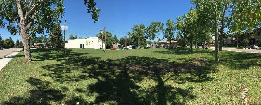
Centre ST N has significant transportation activity value relating to when it was part of Calgary’s streetcar network, and it remains significant today for its importance as a vehicle thoroughfare. The Tuxedo streetcar ran along Centre ST N from 1909-1947 linking the Highland Park station at 32nd AVE to downtown. The streetcar was replaced by a trolley bus service in 1947 which ran through Highland Park from Thorncliffe to downtown. These services provided an important connection for residents to employment and services in Calgary’s citycentre. The future Green Line North LRT service planned for Centre ST N will help preserve this streets status as a historical transit route. Centre ST N has also provided local residents with important retail and service activity value. Two stores of significance on the street are the North Balmoral Grocery and Sunset Grocery whichwere established in the early 50’s. By the late 50’s Highland Park’s stretch of Centre ST N also had 3 gas stations, a school and church.
Highland Industrial has activity value for the community dating back to the early operations when it employed many neighbourhood men. Park businesses included mechanics, manufacturing shops, lumber yards and the much loved Sunset Drive-In Movie Theater. Today community residents and businesses in the industrial park still consider the industrial area as being part of Highland Park even though it was officially removed from the neighbourhood boundary in the late 90’s and named Greenview Industrial by The City of Calgary.
Highland Park has design value for its streetscape and residential road network which has a classic permeable grid pattern. Throughout the neighbourhood, roads have sidewalks on both sides, few front driveways exist and there are gravel alleys all resulting in a highly walkable neighbourhood. Homes are set back from the street and front yards are landscaped with mature trees and bushes. A number of residential roads are elegantly lined with mature Brandon Elm trees and many of the shrubs are lilac’s which were planted when the homes were first
constructed.
The neighbourhood has significant stylistic value relating to: its cluster of well-maintained heritage homes on 34th AVE NE, unique collection of slope adaptive buildings, and community wide collection of small, low profile bungalows. The 34th AVE NE heritage homes are found between 1st and 2nd ST. They were built pre-WWII between 1910 and 1930; many were constructed outside the neighbourhood and later moved. These heritage homes have a range of architectural styles from 2 storey houses to small bungalows. The collection of slope adaptive properties built since the 60’s can be found on the east side of 4th ST NW with some additional properties also found on Center, Center A and 1st Streets NE. Many are multi-family dwellings built into the steep hillside giving the appearance of a small massing from the street matching the neighbourhood aesthetic of low profile housing. Two thirds of neighbourhood homes were small, detached, single-family bungalows built between 1946 and 1956. They are mostly built on 50 foot lots and have a horizontal emphasis with low pitched hip or gable roof. Bungalow architectural styles range from Minimal Traditional to small Ranch. Highland Park’s most significant resident, Ralph Klein, spent much of his childhood living in one of these modest bungalows at 3401 1 ST NE. As a young child he lived there with his mother and father, Florence Harper and Philip Klein. He later returned to the community as an older child to live for a while with his grandparents Christine Harper and Hollins (Harry) Harper. For some of his childhood he attended the community school Buchanan elementary.
Highland Park’s ravine on Nose Hill’s southern slope has prominent geographical landmark value. The steep walled ravine is a continuation of "the North Hill Coulee" which became part of Confederation Park in the mid 60’s. In the middle of the ravine there is a confluence of small streams which join a main creek that eventually flows into Nose Creek. In the 60’s water issues in the ravine caused a landslide resulting in the rare action to divert the main creek through an underground storm water conveyance. The ravine still has its steep walls with stands of mature trees running through the valley bottom. The community has formed a strong attachment to this natural landscape and its beautiful views which provides a significant portion of Highland Park’s visual green-
space.
The ravine also has symbolic value for residents who have a sentimental attachment to the land and its history. Late in the 18th century settlers began farming in Highland Park; on the southernmost portion of the ravine on the Laycock Acreage the Laycock family ran the Laycock and McDonald Dairy and the Springfield Stock Farm from 1914 to 1925. By the 50’s when neighbourhood homes were being built, children played in the ravine on the prairie and in the creeks. In 1965 the Adderson family built and started operating The Highland Golf & Country Club which ran until it was closed in 2011. This 42 acre, 9 hole public golf course was a significant part of neighbourhood life providing residents with a leisure activity and a clubhouse where residents would go for lunch and drinks providing a much needed place to socialize in the community.
Character-Defining Elements
Key elements that define the character of Highland Park include, but are not limited to:
Northern neighbourhood, with bounding streets:
East - Edmonton TR NE
North - McKnight BLVD and Laycock DR
West - 4th ST NW
South - 32nd AVELarge portion of community located on flat plateau. Neighbourhood east of Centre ST N drops steeply to Nose Creek. Topography creates significant views looking out over the Nose Creek valley while also physically bisecting residential areas into east and west sections.
Nose Creek tributary runs through steep walled coulee on NW corner of community.
Centre ST N provides north-south access for city.
Mixed land use with urban boulevards, residential area, golf course and industrial park.
Significant Centre ST N Urban Boulevard -
Historical transit route for Tuxedo streetcar, trolley bus service and major vehicle thoroughfare.
Single retail stores with off road parking in front. One storey buildings with flat roof and symmetrical façade with a central door and window each side.
Heritage Residential Road Pattern and Streetscape -
Permeable grid pattern streets with gravel alleys, aligned to Centre ST N.
Sidewalks are on both sides of streets and few front driveways exist. Uniformly planted mature Brandon Elm trees line a number of roads.
Consistent neighbourhood property design, wide lot with small, low profile home. Regular landscaped setback with mature trees and bushes planted in front yards.
Historic Residential Homes -
On 34th AVE NE between 1st and 2nd ST rare collection of pre-WWII homes built outside community and later moved. Constructed between 1910 and 1930.
On 4th ST NW, Centre ST N, Centre A ST NE and 1st ST NE slope adaptive properties:
1 - 2 stories below grade on the downslope and 1 - 2 stories above grade street side.
Flat or shallow pitched gable roof.
Small massing from the street with minimal shadow effect on adjacent properties.
The predominant neighbourhood homes are small, low profile bungalows built between 1946-56 generally following either of the following architectural styles:
Minimal Traditional
Low pitched hip or gable roof with eaves that have little overhang.
Minimal architectural detail.
Most homes have horizontal siding of a single colour.
Large picture window sometimes with shutter details.
Many have platform steps leading to a small porch sheltering the front door.
Small Ranch
Low pitched hip or gable roof with large, boxed in eave overhang. A few homes have a perpendicular gable to the main gable.
Long, broad design with strong horizontal lines and minimal architectural detail.
Many have two materials used for cladding, horizontal bands of coloured siding below a large picture window and contrasting coloured stucco above covering the top two thirds of the house.
Highland Park NW Ravine and Golf Course Landmark -
Prominent steep walled ravine part of "the North Hill Coulee" which extends from Confederation Park to Nose Creek.
Confluence of small streams flowing off Nose Hill, part of Nose Creek natural drainage system. Rare example of creek vaulting.
Significant portion of Highland Park’s visible but privately owned green-space. Beautiful views of natural ravine topography and mature trees looking from 40th AVE NW, 44th AVE NW, Laycock DR NW and Centre ST N and from the rear of residential properties along 4th ST NW.
Centre of converging trail networks from Confederation Park, Nose Hill and Nose Creek.